
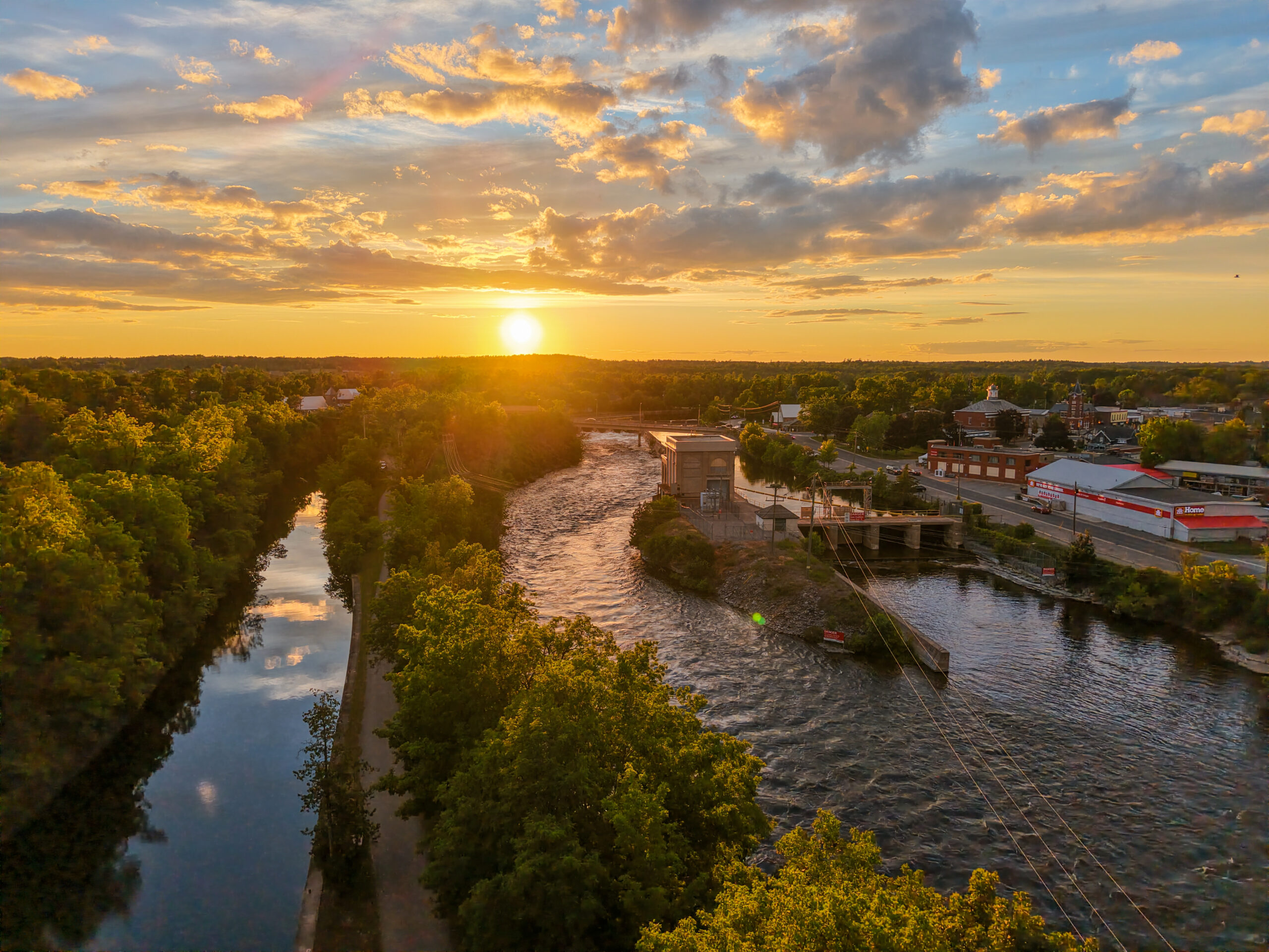
From June 20th to June 27th, we transited forty-three locks through the Trent Severn waterway. The beauty of this place is hard to describe in words, so we hope you will see it for yourself by watching George’s video of our journey through the Trent Severn waterway.

Having said “good-bye” to our guests the prior day, George Reiss reverted to his default mode of “strictly business; no rest for the weary.” We were up at 0500 the morning of June 20th, and were off the dock at Kingston by 0515, across Lake Ontario and into the Bay of Quinte, headed for the town of Trent and the start of the Trent Severn Waterway. Seventy-one miles later we arrived at the Trent Port Marina fuel dock to take on diesel, then motored one basin over to our assigned slip. We rode our bikes into Trent to check out the local shops and to find a place for dinner that evening. We settled on Tomasso’s Italian Grill, and after a quick stop there to make a reservation, we headed back towards the marina and the grocery store that is located directly across the street from the marina parking lot. We were unsure about the ease of finding (and toting) groceries while along the Trent Severn canals, so we took the opportunity to fully restock our pantries and freezer. That evening after a nice dinner at Tomasso’s, we walked a block further to the LBCO (the Liquor Control Board of Ontario) to restock George’s favorite “pantry.” As the sun was setting, we strolled back to the marina along the wide public Riverwalk, admiring the graceful swans gliding beside us on the river.
The marina is located less than two miles from the first lock on the Trent Severn, but since it was still early in the season, the lock was operating on reduced hours and did not open for the first transit until 0900. That left us plenty of time the next morning to ready the boat for departure, which in our case typically means filling the water tanks, disposing of all trash and recycling, and securing all loose items in the boat so we are prepared for rough water or a random big wake from a passing boat. It also left us time that morning to take luxuriously long showers in the first-class individual bathrooms – the marina also provided lush towels and individual bathmats! It was such a treat. Although George usually takes advantage of marina showers, I typically prefer to shower on our boat, but even I couldn’t resist the spa-like showers that were sparkling clean. We also took advantage of the spotless laundry facilities that the marina provides to its guests free of charge and in short order had laundered all our sheets and towels. Assisted Living has a nice sized washer and separate dryer onboard, but for heavy items like bedding and towels, it takes longer than a typical household washer and dryer, so it was nice to be able to knock out that task while we were showering.


With showers and laundry complete, we left Trent Port Marina, passed under four bridges, and were still at Lock 1 (Trenton; 18’ lift) when it opened for business at 0900. We pulled into the lock behind a Ranger Tug 29 named Why Knot. This was the first lock where George had to both pilot the boat into the lock and also man the lock line at the bow (we were missing the Gittards), but he pulled it off without a problem, and thanks to the “marriage saver” headsets we use to communicate, our first lock without additional hands onboard was also without drama.

We followed Why Knot into the second and third locks (Sydney; 20; lift, and Glen Miller; 27’ lift), and as we watched the outflow from the dams push that smaller and lighter boat around as it approached each lock, we were grateful for our heavierRanger Tug 43. Before Lock 4 (Batawa; 18’ lift), Why Knot pulled over to the lock wall to let their puppy get off for a doggy break, so we moved into the lead, making sure when we entered each lock to pull as far forward as possible to leave plenty of space behind us for the twenty-nine-footer. Locks 4, 5 (Trent; 18’ lift) and 6 (Frankford); 18’ lift were uneventful, but as we left Lock 6 the waterway was absolutely clogged with weeds, growing from the bottom to just below the surface. As we left the lock, it felt like we were dragging a dock behind us (not that we have done that, it just seems like that is what it would feel like). Once both boats had cleared the lock, we motioned our intentions to Why Knot, then stopped Assisted Living and reversed for a bit until we felt the weeds release their stranglehold on our props.
Although it is generally very pretty along the Trent Severn, after lock 7 (Glen Ross; 9.8’ lift) we saw many trailer parks and trailer homes along the waterway. As we transited locks 8 and 9 (Percy Reach; 20’ lift and Meyers; 16’ lift), the afternoon wind and clouds started to build, and the weather looked threatening, but after lock 10 (Hagues Reach; 24’ lift), the ominous clouds disappeared just as quickly as they had arrived, just in time for us to transit the Ranney Falls double lock (11 and 12; a combined 48’ lift), where we had planned a short stop to check out a suspension bridge and gorge at Ranney Falls. After exiting lock 12, we pulled over to the grey line along the lock wall. In Canada, at the entrance and exit to most of the locks, there are areas along a bulkhead for tying up a boat either to wait to enter the lock (the space designated by a blue line) or to tie up a boat for temporary or overnight mooring (the grey line). We secured Assisted Living to the cleats along the grey line, then hopped off the boat to cross over the swing bridge spanning lock 12. A short walk brought us to a suspension bridge spanning the deep crevice of the Ranney Gorge. A short distance away, water thundered over massive boulders falling to the bottom of the gorge.
When we returned to Assisted Living, Enchanted Circle was exiting lock 12, so after she passed, we slowly followed her down the waterway to the town of Campbellford, where we had a reservation to moor for the night on the town wall. Many of the villages along the narrow waterway maintain long bulkheads for transient boats, which makes it convenient and safe for passing boaters to stop and spend money. The Town to Campbellford has figured out a great system; their town wall has traditional dock pedestals for shore power and water, and unlike most alternatives for overnight mooring along the waterway, mooring is by reservation only, so once you have secured your reservation you have a guaranteed spot with power and water. Most places to stop along the Trent Severn are first come first served, so you don’t know until you arrive whether there will be space for your boat. If the wall is full, you just must keep going. Even when there is space along a wall, you don’t know if you will be lucky enough to get a space that provides power and water.
Let’s just say that the control freak writing this post is a big fan of the certainty provided by the system at Campbellford. As you approach the town wall, you are told to look for a sign with your boat’s name, indicating your spot. While we held back waiting for Enchanted Circle to secure to the wall, a woman appeared to their stern holding up a sign with “Assisted Living.” We eased into our slot, happy to have a great place to stop after such a long day of locking, which included eleven bridges and thirty-one slow miles. Just in front of Enchanted Circle was Why Knot, with whom we had chatted all day as we locked through the first twelve locks together. Everyone was happy to get off their boats and stretch their legs on the lovely green lawn adjacent to the wall, and soon we had all congregated at a picnic table to share cocktails and our first impressions of the famous Trent Severn.

And that’s when we realized what a small, small world it was. It turns out that Tim and Kathleen on Enchanted Circle (hailing port New Mexico), both grew up in Tulsa, Oklahoma, which is also my hometown. Tim and I both went to Memorial High School. What are the odds? I had made a dinner reservation that evening for Capers, and when Tim and Kathleen decided to join us, we called the restaurant and changed it to four. Before long we had convinced Jim and Jeni from Why Knot to forego dinner onboard and join us as well. We called again and changed the reservation to six. As we headed back to our boats after dinner, we stopped in the park to take a group photo in front of one of Campbellford’s unique attractions, a giant replica of a $2 Canadian coin, a “Toonie.” There was no placard to explain why the town decided to invest in, of all things, this piece of art, so we were left to wonder – what were they thinking?


Since the locks were still operating on reduced hours and would not open until 0900, there was no rush to get off the town wall the next morning. On the way in the prior afternoon, we had spied a gas station just across the road from the waterway about a mile back that advertised propane refills. Since the tanks for our propane stovetop and oven are a nonstandard smaller size, we must refill our existing tanks and cannot just swap them at an exchange like we do for the BBQ back home. Discovering a convenient place in Canada to refill was a real find, so George loaded our spare empty tank onto the back of his bicycle and rode down for a refill. Once refilled, the station insisted that the tank had to be transported vertically, so George somehow managed to balance the tank upright strapped to the back of his bike.
He returned in plenty of time to reinstall the tank, make another quick spin around on his bike to check out the town, and for us to be at the entrance to Lock 13 (Campbellford) when it opened at 0900. We followed a different Why Knot into the lock chamber (a very popular name – so far, we have travelled with at least four different boats named Why Knot and expect that we will encounter others before we close our loop). Depending on the location of the valves within the lock chamber (or just the preference of the lockmaster), some locks require you to secure to the starboard side of the chamber, while others require that you secure to the port side. To this point on the Trent, we’d been able to secure to starboard chamber walls, which is our preferred side since our helm and helm door are both to starboard on Assisted Living. Across from the helm station to port is a sliding window that is accessed by crawling across the banquette seating for the salon dining table. This was the first lock without additional hands onboard where we were required to secure to our port side, so at the last minute we did a Chinese fire drill moving our bumpers and lines from our starboard side over to port, and then George had to bring the boat into the chamber from the starboard side helm station, and then dart across to the port window opposite the helm station to grab the vertical cable hanging down the port chamber wall. He did a great job getting a line around the cable and then releasing it once we had finished locking up and getting back to the helm, starting our engines and maneuvering us away from the port wall and out of the chamber.
We spent the rest of the day locking through with the newest Why Knot, and we really learned to appreciate the Why Knot from the day before. The newest Why Knot was incredibly tentative at the helm and took forever to get situated in each lock. The helmsman did not assist his female mate in securing lines to the cables, so she scrambled up and back while their boat drifted crosswise to the chamber wall, requiring the boat to be repositioned over and over again, until she was finally lucky enough to work out the timing to get the boat secured to the lock wall. It made for a very long day for all of us.

Lock 14 (Crowe Bay; 23’ lift) presented a fun challenge. The lock’s associated hydro power station was undergoing maintenance and so no waterflow was being directed there; instead, it was all going over the dam that spills out at the entrance to Lock 14. It made for a tricky approach. While George was wrestling the controls, I was running around moving our lines and bumpers from port to starboard. Lock 15 (Healey Falls; 22’ lift) was back to a port tie, then .3 miles after Lock 15, thankfully the double lock at Healey Fall Flight (Locks 16 and 17; combined 54’ lift) was also a port tie. But of course, the final lock of the day, Lock 18 (Hastings; 9’ lift) was back to starboard tie. By this point, I was wishing we had paid closer attention to the AGLCA seminar speaker who had mentioned that it was a good idea to carry enough fenders so the boat could stay continuously outfitted for locking on either side without the need to move lines and fenders. We will adopt that plan when we start down the inland rivers and once again encounter locks (aided by the discovery of two forgotten large bumpers stowed deep under the flybridge seats; providing another good lesson from the loop, that it is all well and good to inventory all the items stashed in the bowels of your boat, but the inventory is not much use unless you occasionally glance at the list to remind yourself of what you have forgotten).

Generally, the lock staff on the Trent is known for being friendly and professional, but the staff at Hastings, for whatever reason, was neither, and it translated to significant disrepair within the lock. The cable nearest our bow for George to secure our line around for locking only had three intact strands in what is usually a full one-inch cable. Fortunately, it was one of the shorter locks up (only nine feet), so we floated up without incident.
After existing Hastings Lock, we approached what appeared to be a closed low railroad bridge, but we knew from the excellent guide shared by the AGLCA Trent Severn Harbor Host (AGLCA members local to a particular area who volunteer to provide information and be a resource for other AGLCA loopers) that the bridge is permanently open, but its opening is not apparent until you round a curve and are practically right up to the bridge. Without the Harbor Host guide, I wonder how long we would have waited before the curve, futilely trying to radio a nonexistent bridge tender to request an opening.
We proceeded into Rice Lake for the next seventeen miles, then turned into the Ontonabee River through an entrance that was full of weeds. We felt the drag of weeds again, so reversed our props to get clear of them. We turned into the first oxbow north on the river and anchored in fifteen feet of water. After six bridges and six locks we were happy to settle into the secluded spot and enjoy a beautiful sunset and a home cooked meal.

George was up at 0500 the next morning to start the generator to recharge our house bank of batteries and to chart our route for the day. He should have had his coffee before route planning, because he somehow miscalculated that it would take us an hour and a half to get to the next lock. Realistically, it was a three-hour trip. Although we had planned to be there for the first lock opening at 0900, it was after 1000 before we made it. At Lock 19 (Scott Mills; 8’ lift) we followed a rental boat, a Le Boat, into the lock. The Le Boat could not drive straight, and if it hadn’t been so early in the morning, we would have suspected the captain of being drunk. We learned later that Le Boat advertises that “no prior boating experience is necessary” and it became clear as we encountered several Le Boats along the way that their customers believe them. We were stuck with Captain Clown on Le Boat for all the locks that day and watched with dismay as he plopped a fake Captain’s hat on his head and steered his boat like a kid ‘driving’ a mechanical toy car at a 1960s grocery store.

By 1100 we had cleared Lock 20 (Ashburnham; 12’ lift) and were headed to Lock 21, the Peterborough Lift Lock. The Peterborough Lift Lock is the highest hydraulic lift lock in the world, ascending sixty-five feet, and is only one of two hydraulic lift locks in North America (the other one being the Kirkfield Lift Lock, which is also located on the Trent Severn). A hydraulic lift lock operates on a balance principle. A constant water pressure supports both the lower and the upper lock chambers, which are two identical bathtub-like ship caissons in which vessels simultaneously ascend and descend. As extra water is let into the upper chamber, the now heavier lock automatically descends, lifting the lower chamber. The lift lock functions by gravity alone using the counterweight principle. Here is a link is a more detailed description of how the lock works for you engineer types.
We followed Captain Clown into the lift lock, staying as far back as the chamber allowed, both to distance ourselves from the Le Boat, and to have the best view of the “infinity pool” effect as the lock chamber rose above the horizon. George included some wonderful footage of Assisted Living locking up at Peterborough in his video covering the Trent Severn.


After the Peterborough Lock, we took advantage of a wide spot in the waterway to pass Le Boat. Captain Clown’s inability to steer straight or to proceed at a constant speed was driving us crazy. We passed under six bridges and cruised the waterway through the heart of the Trenton University campus, steering around swimming co-eds jumping off the wide steps from campus leading down to the canal. As we approached Lock 22 (Nassau Mills; 14’ lift), we saw a backlog of boats waiting on the lock and crazy current spilling across the lock approach. Four boats had just loaded into the chamber to lock up, so there was just enough room for Assisted Living on the blue line behind Tim and Kathleen on Enchanted Circle. Prior to our arrival, Enchanted Circle had literally burned up one of its thrusters trying to hold position in the current when none of the four boats then on the blue line would move up to make room.
While we waited on the blue line for our turn to lock, Captain Clown appeared on the horizon. Since he couldn’t control his boat even on the calm and protected fairways of the waterway, you can imagine what a fiasco it was when he hit the spill off from the dam. Rather than hold position just before the swift current, Captain Clown continually charged up the spillway, then lost control of his boat and was pushed either towards us or the shore behind us. We tried to get word to him that he would be better served by staying back and holding his position in the calm waters, but he couldn’t hear us over the screaming of his motors as he continually gunned them. When we mimed using a VHF radio to talk to us, we learned that the rental boats are not equipped with VHF. Of course.
After what seemed like an awfully long time (but was probably less than thirty minutes), it was our turn to lock through. Enchanted Circle was now working on one of their engines (when it rains, it pours), so they stayed on the blue line. Assisted Living proceeded into the lock chamber with Le Boat lumbering in behind. At the next lock, 23 (Otonabee, 12’ lift), we were again first to go in, and this time, instead of lumbering, Captain Clown decided to floor it and was charging directly for us. I had just finished moving our lines and fenders to starboard, but when I saw Le Boat beelining at full speed for our stern, I got flustered trying to get a fender loose to hold between us and Le Boat. In the chaos, my sunglasses were knocked off and when I bent down to try to grab them as they floated towards the bottom of the lock, my “marriage saver” headset came loose and fell in the water. The marriage saver is always clipped to me with a safety lanyard, but my expensive pair of Costa sunglasses is now a resident of Canada (this is why I can’t have nice things). Despite the dunk into the nasty lock water, my headset survived after being treated with a Clorox wipe, a hairdryer and a fresh backup lithium battery.

For the next three locks, 24 (Douro; 12’ lift), 25 (Sawyer Creek; 10’ lift) and 26 (Lakefield; 16’ lift), we positioned as far forward as we could possibly go in the lock chamber, hoping to keep as much distance between us and the idiot piloting the Le Boat. While that decreased the likelihood that we would be rear-ended, it placed us front and center to the lock’s water inlet valves. As the water rushed in to fill the lock and lift us, holding Assisted Living in place against the force of the incoming water was exhausting. Note to self – stay back in the locks from now on. After exiting Lakefield lock, we pulled over to the grey line for the night and hooked up to shore power. After passing under twelve bridges and transiting eight locks, we certainly earned the beer we enjoyed on the flybridge that evening. After recovering, we biked into town to have dinner at the Canoe & Paddle, where we were able to catch the tail end of one of the Soccer World Cup matches. Back at the boat, George made friends with other boaters as he droned the sunset, at least until one of the lockmasters walked by and told him that the Trent Severn is a national park, so no droning is allowed. So, enjoy the contraband drone footage that George included in his video of the Trent Severn; apparently it is rare.
We dropped our lines from the lock wall in time for a leisurely one-hour motor to arrive at Lock 27 (Young’s Point; 7’ lift) in time for the first lock of the day at 0900. As we were exiting after locking up, we saw that Captain Clown had arrived on the blue line below and was waiting for the next lock through. Thank goodness we are early risers. I don’t think we could have taken another day of locking through with the Le Boat. Leaving Le Boat in our rear-view mirror, we headed out onto Clear Lake, which was created by the dam at Young’s Point on the Otonabee River. The landscape along the Trent had gradually changed from limestone and grassy marshlands to the rocks of the Canadian Shield. The Canadian Shield is a massive region of ancient Precambrian rock that forms the geographic core of North America. It covers roughly half of Canada, with exposed bedrock, thin soils, wide expanses of boreal forests, and thousands of lakes. It is breathtaking.
We passed a tiny island which is the home to St. Peter’s Church on the Rock, which is accessible only by boat and offers Anglican services during summer months, then passed through Hells Gate, which is narrow, twisting, full of rocks and hidden shoals near the surface, and has virtually no soft bottom as it cuts directly through the hard pink and orange granite teeth of the Canadian Shield. The channel through the cut is well marked.


As we approached Lock 28 (Burleigh Falls; 24’ lift), we saw rapids on both sides of the chute into the lock. At the bottom of the tall lock with the huge metal doors closed, it felt like being in a tomb, and the ascent was impressive, raising us twenty-four feet in about six minutes. We were in and out in less than ten minutes, including the time it took us to enter the lock and get secured on the chamber wall. The exit to Lock 28 is into Kawartha Lake, and from there we weaved our way through islands and fifteen minutes later arrived at Lovesick Lock (30), which is itself located on an island (Hewit Island; the lock staff arrives by boat every morning). The lift at Lovesick was minimal; only three and a half feet up, and upon exiting we tied to the port upper grey wall for a quick visit to go in search of the natural hot tub that is reportedly at Wolfe Island Provincial Park. We walked over the top of the lock and the spillway/dam to Wolfe Island Provincial Park and followed a trail to the water’s edge on the opposite side of Wolfe Island. All we found were firepits, but on our way back to the boat, we came across a dammed-up area at the beginning of the trail near the spillway where the heat of the rocks warmed up the water flowing through them and spilled with swirls into a shallow basin, creating a natural hot tub.

Back onboard, we forgot one of the important reasons we had decided to stop and departed the lock wall without lowering the masthead on our flybridge. With the masthead up our air draft (the highest point of our boat as measured from the top of the water) is 20’6”. After the next lock, we would have to go under a bridge that with the current high-water levels on the Trent was reported to be around 19’. Once we realized our oversight, we found a relatively open spot on the waterway and engaged our DPS (Dynamic Position Stabilization) to hold the boat in place while George and I went up to the flybridge to wrestle down the masthead. It would have been a perfect plan, if only we had realized that lowering the masthead upon which the DPS GPS sensor is located would cause the DPS to lose its guiding signal (duh, instead of pointing at the sky, when lowered it pointed to the trees on shore). When we realized that the DPS had stopped working and the boat was being blown from its position, I abandoned George and darted down to the main helm station to take control of the boat (although there is a helm station at the flybridge, we could not open it up with the masthead pinning the helm station covers closed). I think this is a lesson that we will remember in the future. So, so many lessons to be learned on the Loop.
There was a wait to transit Lock 31 (Buckhorn; 11.5’ lift) so we tied to the blue line to await our turn. Before the lock opened to release the boats that were locking down, the lockmaster found us on the lock wall and asked us to move the boat further from the lock doors. Apparently, there was a large rental houseboat that would be exiting the lock, and the lockmaster was concerned about the captain’s ability to navigate around the boats waiting to enter the lock. Remembering rental boat Captain Clown, we happily pulled back out of the way.
We cleared Lock 31 is short order, then proceeded to the lowest bridge on the Trent, the Gannon Narrows. Bridge. With our mast down, we easily passed underneath, although we noticed that we only had a few feet of clearance between the bottom of the bridge span and our VHF antennae, which we had not bothered to lower. We entered Pigeon Lake to take us to Lock 32 (Bobcaygeon; 5’ lift), which was our last lock of the day. By 1600 we were through Bobcaygeon Lock and tied up the starboard grey wall. The grey walls on both sides of the waterway were full of boats so we could not get a spot with shore power. Shortly after we arrived, Enchanted Circle (Tim and Kathleen) and Oma (Paul and Suzanne) tied up to the grey wall just across the waterway from us. We ran into both couples when we walked over to explore the town of Bobcaygeon, and later we all met for dinner at Amici. When we returned to the boat after dinner, I realized I had gone to dinner wearing two different sneakers. Even though we only went under nine bridges and transited five locks, it had been a long day, and I wasn’t on my “A” game (do I even have an “A” game when it comes to fashion? Certainly not on this trip – and if I am being honest, probably not at home either.)

The next morning, June 25th, we were underway by 0625 with the goal of making it to Lock 34 (Fellon Falls; 24’ lift) when it opened at 0900. When we arrived at 0830, the portside blue line was lined with large rental houseboats. We tied up to the starboard blue line and took a short walk to explore the pretty little town and look at Felon Falls. We returned to the boat in time to assist Enchanted Circle with her lines as she pulled up behind us. At 0900 the big steel lock doors opened and over a loudspeaker the lockmaster broadcast directions for the waiting boats. She first called for two of the large rental houseboats, but only one entered the lock, and the other motioned to the rest of us that he was not going to lock through at that time. Next the lockmaster called for us, but the solo captain of a small day boat was clueless slipped ahead of us to enter the lock first, securing to the port wall. Since the lockmaster had planned to stack us with the small boat and he was already to port, as we entered the lock we had to move our lines and fenders from starboard to port. George had to remove the screen on the port window so he could get a line on and grab the cable on that side. Despite the last-minute changes, all went well. We were out of the lock by 0925, and the same group of boats proceeded to lock through together at 35 (Rosendale Lock, a mere 4’ lift). After Lock 35, we crossed Balsam Lake, then entered the Trent Canal, which is so narrow that there is no room for boats traveling in opposite directions to pass. We broadcast a Securite’ call over VHF to advice concerned traffic that we and Enchanted Circle were entering the canal headed upstream. Criag, on s/v Resolute, whom we had met in Amsterdam, NY, answered our Securite call to advise that he had just exited the canal headed upstream and there were currently no boats in the canal headed downstream.


We arrived at Lock 36 (Kirkfield Lift Lock; 49’ descent) just as the gates were opening. Kirkfield is the second hydraulic lift lock on the Trent and is the highest point on the waterway, so we locked down at Kirkfield instead of up. Assisted Living and Enchanted Circle eased into the chamber tub and were swiftly lowered 49’. Since we were now headed downstream, we flipped the marker reminders that we have mounted on the helm, to remind us that now we are red-left-leaving (upstream had been red-right-returning).

After Kirkfield, the water depth was distressingly shallow. Several times our depth meter (which reads the available depth after adjusting for a 3.5’ offset to account for the depth of our props) registered “0.0” and once we even saw “-1.7”! To add to the worry, the waterway was chocked with weeds growing from the bottom to to just below (and sometimes above) the surface of the water. We later learned that Enchanted Circle, following behind us, bumped some sunken logs in some of the shallower spots. So far as we know, we did not hit anything. To distract myself, I prepped food for dinner, and even baked some cookie (I am known for “stress baking” and if you have ever enjoyed my homemade cookies, it is likely that you were the beneficiary of my efforts to relieve my worries).
At Lock 37 (Bolsover; 22’ descent), we had to wait for a full lock ahead of us. Once inside and secured to the lock chamber, we experienced once again (first experienced in the Erie Canal), spitting zebra mussels, which are mussels clinging in mass to the lock wall that “spit” streams of water. We held our lines around the chamber lock cables and tried to stay dry (and we were “mostly” successful). George included footage of this interesting phenomenon in his video covering the Trent Severn.
Our goal for the day was to get past the final swing bridge after Lock 41 at Gamebridge so we would be positioned for an early morning start to cross the wide expanse of Lake Simcoe. Because of the size of the lake and the prevailing wind direction, the lake can develop a nasty fetch over the course of the day, so we did not want to be held up by the late morning (0900) lock schedule; instead, we planned to depart by first light the next morning. To get past Gambridge, we finished the current day by transiting the final three miles and in quick succession Lock 38 (Talbot; 14’ descent), Lock 39 (Portage, 13’ descent, Lock 40 (Thorah; 14’ descent); and Lock 41 (Gamebridge; 11’ descent). After clearing through Gamebridge we passed under a road and rail bridge, and our final hurdle, a swingbridge, that opened for us as we approached. Our only option for mooring was a tall breakwater just past the swing bridge just before the entrance to Lake Simcoe. The top of the breakwater was about eight feet above the water line, but by standing on our bow I was able to lasso a cleat, then hop off the boat and run back for the stern line, which George tossed up to me. It had been another long day with 19 bridges and 8 locks. We helped Enchanted Circle pull in behind us, then we all met on Assisted Living for end of the day cocktails and charcuterie. By the time we wound down, George and I were sated and decided to hold off cooking the meal that I had prepped for dinner (Yay! One less task for the following day.).


The next morning, George was up by 0500 to check for sunrise and start the generator. It was cloudy and foggy, so he went back to bed a short while. We heard Enchanted Circle leaving around 0545, so we got up and starting prepping Assisted Living to leave. As we had hoped, Lake Simcoe was calm and we made good time getting across. As soon as we got off the lake, we stopped in Bridgeport Marina to take on fuel and pump out. The marina staff wondered where all the loopers were, as they had not seen many yet this season. We assured them that a huge pack of looper was following behind us (another marina recently told us that using the Nebo app they had counted 369 active looper flags in the area!).
Up ahead of us, we heard from Enchanted Circle that the 14’ railroad bridge at mile marker 209.1 (Loopers, take note of this one….) just before Lock 42 would not open until 0900, and even then, if there was a train expected, it would not open until later. We figured that if we burned some fuel, we could likely catch up to Enchanted Circle and be in position to go under the bridge together since we had heard reports of the bridge tender there being finicky and onery (which it turns out, was an understatement). We caught up with Enchanted Circle by 0940, still waiting for the railroad bridge to open. We could see that there was a line of boats on the other side of the bridge also waiting for the opening. While we waited, Kathleen coordinated with the upstream boats and it was decided that when the bridge opened that those of us headed downstream would hold in place to allow upstream boats to pass, since the channel was a little wider on the downstream side. At 1015 the bridge finally opened and upstream boats passed, then we tucked in behind Enchanted Circle to pass heading downstream. As soon as Enchanted Circle was under the bridge the bridge tender started to lower the bridge, even though he could clearly see us on Enchanted Circle’s tail. In a game of chicken, George gunned it under the closing bridge and rather than hit us, the bridge tender halted (very, very briefly) the bridge coming down. What a jerk! We have heard many horror stories about this bridge tender. He (or she) must be a very unhappy person.
Less than a mile later, we arrived at the entrance to Lock 42 (Couchiching, 20’ descent), but it was temporarily closed for maintenance. We tied off to the blue line and George and Tim walked over to watch the work and talk to the construction team, which George found fascinating. He watched the crew drain all the water from the lock chamber so they could work on the hydraulics. He got some interesting footage of the crew dropping the protective dam in front of the antechamber once the pressure and water level had been equalized. After forty-five minutes the maintenance was complete and the lock chamber once again filled with water, allowing us to lock down.


Next up was the Hamlet Swing Bridge, which opens on demand to boats that signal with three blasts of a horn. We cleared that by 1145 and Enchanted Circle pushed ahead as they were hoping to get through the Big Chute (Lock 44) before the end of the day. We planned to stop short of there at Waubic Island, so we dawdled along, even stopping to fold back our flybridge bimini. Enchanted Circle was waiting on the blue line when we arrived at Lock 43 (Swift Rapids; 47’ descent), while three boats headed upstream exited the lock, so we fell behind Enchanted Circle and entered the lock without delay. Swift Rapids was the fastest descent to date; we went down 47’ in less than six minutes. It was smooth as silk, but we were definitely hanging on during the ride down!
We had hoped to anchor near Waubic Island, but there was another problem with our windlass (yes, another problem), so we bagged anchoring and took a slip at the Waubic Restaurant. Poor George, for the umpteenth time, disassembled and reassembled the starboard windlass, then we walked over to the restaurant to pick up take-out burgers for dinner on our flybridge.


The next day, June 27th, was our final day on the Trent Severn waterway, and our much-anticipated encounter with the Big Chute. The Big Chute, Lock 44, is the only operating marine railway of its kind in North America. Boats enter a submerged rail carriage, and lock staff expertly secures the boat using adjustable slings, lifts the boat out of the water resting its hull on the carriage, which carries it across a 60’ hill on land to bypass a local road and a rough waterfall area. The carriage descends into the water on the opposite side of the road where the sling loosens and the boat floats free. Boats with exposed running gear, like the pods on Assisted Living, pose a particular challenge for the lock staff. The vessel must be positioned on the carriage on the vessel’s center of gravity to ensure that the main weight rests safely on the carriage bed but must be far back enough to allow the aft pods and running gear to extend unsupported over the rear of the carriage. Basically, we were lifted out of the water and rode a marine roller coaster with about eight feet of our back end hanging out. It was a bit nerve-wracking since so much weight of the boat is concentrated in the pods and engines, but the lock staff assured they had it, and indeed, they did. We filmed the experience and it is included in George’s video of the Trent Severn.


As we existed the Big Chute, one of our rear bumpers came untied, but we saw it floating free and were able to do a quick circle and execute a man-over-board drill to successfully rescue it. After a final eight miles, we locked through number 45 /im(Port Severn; 12’ descent) and left the tranquil Trent Severn waterway for the equally magnificent Georgian Bay.