
After completing the repairs to our anchor roller, we pulled out of our slip at Coral Ridge Yacht Club on February 9th, headed north for Delray Beach, which was located about twenty miles north up the Intracoastal Waterway. The southeast coast of Florida is heavily populated and the intracoastal waterway cuts right through the mainland to the west and the barrier islands to the east. Both sides are cram packed with people, businesses and cars, and that means lots of bridges crossing the waterway. In that twenty-something miles, we had to pass through nine bridges. Our air draft allowed us to scoot under five of them since we timed our travels for low tide. However, without folding down its instruments mast on the flybridge (doable, but not desirable) Assisted Living was too tall to clear the other five bridges, so we needed those to open for us to pass.
A bridge opening requires traffic on both sides to be halted while the bridge is opened to allow maritime to traffic to pass through. In other parts of the country, some bridges will open upon request, but in busy south Florida, almost all bridges will only open at certain scheduled times; some on the hour and half hour, others on the quarter hour and the quarter ‘til. Needless to say, it becomes important to time your arrival shortly before a scheduled opening. If you are even a few minutes late, you must hold the boat in place for thirty minutes or so waiting for the next scheduled opening. If you are early, well, you do the same dance waiting for the appointed time. Fortunately for us, we had just wrapped up two days on the boat with our son who taught us a neat trick. Like many young adults his age, he is a whiz at all things electronic, and our son, in particular, is intuitive about anything having to do with the operation of a boat. In the short trip from Miami to Fort Lauderdale, using our Garmin MFD (multi-function navigational display) he taught us how to automatically calculate the required speed range that needed to be maintained to get from point A to point B and arrive precisely at the time designated for the bridge opening. By entering the starting point (your location), the end point (the bridge) and the desired arrival time (scheduled bridge opening), the Garmin MFD creates an informational ribbon across the top of navigation chart that shows a handy little gauge displaying the maximum speed (exceed that and you will arrive too early) and the minimum speed (fail to achieve that and you will arrive too late) to time your arrival to the bridge perfectly. The max and minimum speeds are noted at the top and the bottom of a vertical line, and anytime you are running above the max speed or below the minimum speed, the top or the bottom of the gauge lights up red. If you are within the desired range, you get the green light. The desired range constantly updates based on real time conditions, so for example, if a no wake zone slows you down, the information displayed automatically adjusts so you know just how fast you need to go once you are allowed to speed up again. In the (not so) good ‘ole days, we were constantly doing the math in our heads, often getting it wrong. This was such an easier way to traverse the bridge-filled waters of south Florida!
We anchored just across from historic downtown Delray Beach in a large open basin surrounded by residential properties (Delray Beach North Anchorage). From the anchorage it was only a couple of minutes by dinghy ride to the free town dock. We were anchored by early afternoon and immediately set off to explore Delray Beach. Since we are not big shoppers, we mainly wandered around visiting local art galleries and checking out the menus of the dozens of restaurants and bars that line the historic district. We found an excellent wine shop/cafe with sidewalk seating and settled there for some refreshments. Despite its extensive and interesting wine collection, the real deal was $5 Old Fashioneds made with Buffalo Trace – hard to beat that! After cocktails, we moved over to Elizabetta’s for some excellent Italian food. Satiated and sleepy, we took the short but very dark dinghy ride back to Assisted Living.


The next morning, February 10th, we pulled anchor just before the 9:45 opening of the nearby Atlantic Avenue Bridge. We spotted manatees just before the bridge, and really throughout a good part of the day, as we passed under or through nine more bridges. We passed magnificent homes and mega-yachts along the ICW in Palm Beach. We traveled past Mar-a-Lago without incident or delays, as the president had departed from there earlier that morning. Along the way, we spotted at anchor the first catamaran sailboat we ever owned, Carpe Vita. We sold her in 2005, and it is so good to see her still alive and well! We cruised on to Peanut Island just inside the Lake Worth inlet. The water was clear and clean. The public docks at Peanut Island were too small for Assisted Living, so we found a good spot to anchor and used the dinghy to visit the beach. George went for a quick swim, while Chris sat on the beach being entertained by hapless folks attempting to anchor their rental pontoon boat (reminding her fondly of Shell Island). The anchorage off Peanut Island was too exposed to the inlet and was too busy with commercial traffic for us to stay there overnight, so we motored back a short distance to find an anchorage in Lake Worth.
On February 11th we were underway at first light. We headed north on the ICW, and at mid-morning approached Jupiter Inlet, the site of troublesome shoaling. Of course, since nothing is simple in our lives, the path forward was packed with half a dozen small fishing boats erratically weaving near the channel looking for bait, and a large dredge setting up to work on the problem shoal. In all the confusion (and perhaps a wee bit due to being distracted by the nearby lighthouse), George almost ran us aground, but at the last minute he stopped the boat and reversed our path to follow Bob’s Tracks, which directed us along a path just outside the marked channel but with greater water depths. Bob423 ICW Tracks are highly accurate GPS navigation files for the Atlantic Intracoastal Waterway created, updated and published by an experienced cruiser who travels the Atlantic ICW annually (on his Beneteau 423, hence the name) and who also crowdsources data from other cruisers to report some of the best real time information out there. For a good discussion of the advantages and limitations of Bob’s Tracks, see this excellent article. Personally, we can certainly attest to its advantages. We always navigate with several sources simultaneously, the maps and information from our chart plotter, also Navionics (which we run on an iPad) and Aqua Map (which we run on a Galaxy Tablet, with Bob’s Tracks incorporated into the Aqua Map display). Most importantly, we never follow any track blindly; we always keep our eyes up and out of the boat looking to the aids to navigation (ATONs) and with a close eye on our reported depth soundings. When those depth soundings alert us to possible problems within the marked channel (relocation of navigation markers can lag shoaling, and storms and strong tidal currents can shift the sand and sediment changing available depth without warning) we are sure glad to have Bob’s Tracks as a resource. A few days after our near miss at Jupiter Inlet, we read of several loopers who ran aground at this exact spot.
After Jupiter Inlet, we made a brief stop in Hobie Sound near Jonathon Dickinson State Park for lunch and a conference call, and afterwards we cruised through Hobe Sound National Wildlife Refuge admiring the extensive mangroves. We entered the St. Lucie River just west of the St. Lucis Inlet and followed the serpentine St. Lucie River north and west into Stuart, Florida, where we anchored for the night at Pendarvis Cove. We had officially left the “Gold Coast’ and were now cruising the “Treasure Coast.”
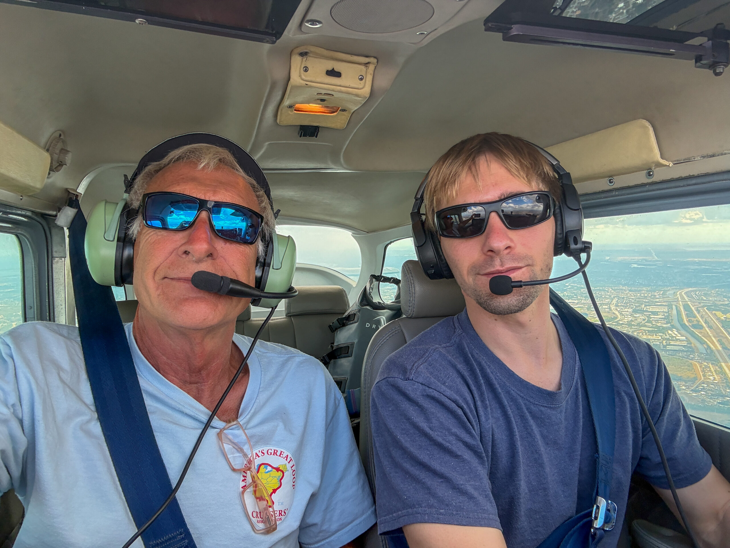
Early the next morning, February 12th, we moved the boat thirty minutes over to Sunset Marina in Stuart, Florida. Since our assigned slip was empty, the marina allowed us to come in early, before the dockhands were there for the day. Fortunately, the slip was generous in size, and we had no issues getting in and tying up without assistance. We had asked to come in early because we had made a last-minute decision for George to fly home to Panama City to be able to attend an important meeting in person. Our son, Taylor, has a private’s pilot’s license and is a member of a flight club that gives him access to the club’s airplanes. Taylor flew from Miami to Stuart, where he picked up George around noon and flew him home to Panama City.


Chris stayed on the boat because we had scheduled the local Volvo mechanic to meet us at the marina to update the software on our engines and do an oil change. Certified Volvo mechanics are few and far between, and the good ones, like Gary Woods the one we scheduled, are booked out for months. It is nearly impossible to get on their schedule. Knowing that we would be due for an oil change based on likely engine hours about the time we would be in the vicinity of Stuart, George had literally been working for months to line up Gary to do this regular maintenance and scheduled software upgrade. Delaying or rescheduling was not an option. George left with strict instructions for Chris to take notes, ask questions and even film the Volvo mechanic so in the future George might feel comfortable handling the oil change himself. Chris used the opportunity to pick Gary’s brain, and he was unfailingly gracious and helpful, patiently explaining everything he was doing, and offering tips and tricks. It remains to be seen whether George will appreciate Chris’ newfound ‘expertise’ if he decides to handle the next oil change himself; something like forty years of experience leads her to believe that he might not be receptive to her suggestions.
George and Taylor had an uneventful flight to Panama City, but it was not without its challenges. They passed through a weak front with some light rain. The clouds kept them from flying at higher altitudes, and when they learned that Perry was out of fuel, they had to backtrack to Cross City. It was after 6pm and dark when they landed in Panama City. It was a long trip, but so cool for George to fly with his son.
After his early morning meeting, George and Taylor headed back to the Panama City airport for the flight back to Stuart. On the climb out from Panama City, the engine sounded rough, so T slowed the assent, then circled the airport until the engine ran well again. Satisfied that they were good, they climbed to 7,500 feet and with a nice tailwind and smooth air headed for Stuart. All was not well, however. After landing in Winter Park, Florida to take on fuel, and prepping to take off from there, the engine again sounded rough. Before taking off, T did an extended run up on the runway thinking the plugs must have gotten fouled, but the engine did not improve and even sounded worse. T wisely stopped on the ramp and called the flight club’s mechanic to discuss the problem. We won’t bore you with all the mechanical details, but it ultimately took several hours, two airplane mechanics (including one genius old school mechanic that was able to make a diagnosis simply by feeling with his hand the unusually cool temperature of one of the cylinders), Taylor with a degree in (marine) engineering, and George with a degree in mechanical and aerospace engineering, to figure out the many (many!) problems with the plane. Two spark plugs were bad, and four of eight had to be replaced. Checking for a fuel leak as an explanation of the engine running rough and dropping RMPs (never a good thing in a plane), they found that one of the bolts holding the intake manifold feeding fuel to the cylinder was missing (had likely fallen off, yikes) and the gasket was barely hanging on, leading to fuel not being supplied to the cylinder (hence, it was cold to the touch). After repairing that, they found that the wiring to one of the magnetos was reversed (and probably had been for a long, long time). After the mechanic corrected the wiring and told them that they were good to go, George suggested that it might be a good idea to check whether the landing light still worked after all the repairs and rewiring. The lights did not work. It was now quite late at night. The mechanic had to remove the cowling to reconnect the landing light and after that he assured them that it was safe to fly. As an added precaution, after taking off from Winter Park, T circled the runway “to gain altitude and have a known place to land in case the plane crapped out” (just what a mother and wife love to hear). Thankfully, the plan was now running fine, and they made their way to Stuart to land just before the FBO closed for the night. T took on fuel and headed back to Miami, and George grabbed an Uber back to the marina, arriving close to 11pm.

Happy Valentine’s Day! After George’s late-night adventures in flying, we slept in a bit and left the dock around 10 a.m., headed to the marina fuel dock to take on diesel and get our holding tanks pumped out (yes, living on a boat is glamorous, indeed). To depart Stuart, we had to request an opening of the Old Roosevelt Bridge, which had to be coordinated with the opening of a railway bridge less than a hundred yards away. By 10:45 we were on our way back down the St. Lucie River. We rejoined the Atlantic Intracoastal Waterway at Rocky Point, and using Bob’s Tracks avoided a shallow spot in the middle of the channel, as a dredge and its trailing pipes went by. As we moved north, we noticed that the houses along the waterfront were no longer the extravagant mansions of south Florida, and there were very few “yachts.” We passed Jensen Beach, where we had taken delivery of Assisted Living nearly three years before. We were now officially north of any of our prior boating adventures.
We pressed on to the Vero Beach Yacht Club, another FCYC club, where we had reserved a slip for the night. The club was having a special Valentine’s Day dinner, and they were able to add a table for us at their early seating. The club manager was visibly relieved when we showed up in nice clothes – a red cocktail dress for Chris and nice slacks and a dress shirt for George (When we’d made the reservation, he had asked, hopefully, “You do have other clothes on the boat with you, right?” Point taken, although unnecessary; we know how to dress for a nice event, for heaven’s sake). We had a beautiful meal and enjoyed chatting with some of their members who were seated at the table next to us.


George has put together a video of this leg of our journey along the Treasure Coast. Unfortunately, we had a hard drive failure and lost many of our photos and videos, but George’s video does a good job showing most of the highlights from Fort Lauderdale to Vero Beach.